

From Orbit to 3D: How Pléiades Neo is transforming Earth reconstruction
Learn how to transform satellite imagery into accurate, immersive 3D environments with guidance from our experts.
What are the basics for creating 3D representations from satellite imagery
Reliable elevation information is key to creating 3D models from satellite imagery.
Because satellite images on their own are two-dimensional, objects such as buildings are only captured from one viewing direction and “flattened”. In order to create 3D products, we capture the same area from different viewing angles to calculate the height information based on those images.
When our Pléiades Neo satellites capture the same area from different angles, objects of varying heights such as trees, terrain and buildings shift relative to one another from image to image. By measuring these shifts, we can derive precise depth information and calculate the height and shape of the respective objects. In the geospatial industry, this process is known as satellite photogrammetry.


Access Pléiades Neo multi-stereo imagery, ready for the creation of 3D products*
Pléiades Neo is a fleet of two identical optical satellites, providing very high-resolution satellite imagery at 30cm GSD to customers worldwide, with unmatched accuracy and flexible tasking capabilities. At Airbus, we rely on Pléiades Neo’s ability to capture multiple images of an area from with different viewing angles during a single overpass, to generate our 3D Mesh product.
With our GIS customers in mind, and for all those who need multi-stereo as the initial source imagery, we are making your journey easier. Airbus has launched 3D-Ready Tasking an option within our OneTasking service that allows you to order multi-stereo imagery directly through our OneAtlas portal.
It has never been easier to get the right imagery best suited for your 3D products.
From multi-stereo imagery to height value
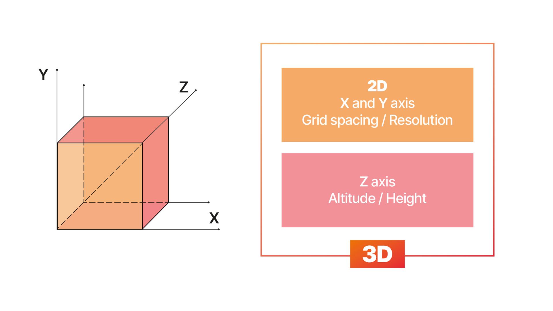
Once multi-stereo satellite images have been acquired, they must go through a photogrammetry workflow that converts 2D images into 3D geometry. First, the software will help you align the orientation of your images, identifying features that will act as tie points between the images. Using the satellite image metadata, the software calculates precise position and orientation of each image in 3D space. Secondly, now that we have the image orientation, the software measures parallax (i.e. the apparent shift in an object’s position when viewed from different locations) to reconstruct depth, creating a dense point cloud where each point has an X, Y and Z coordinate.
From height data to 3D meshes: surface generation and texturing
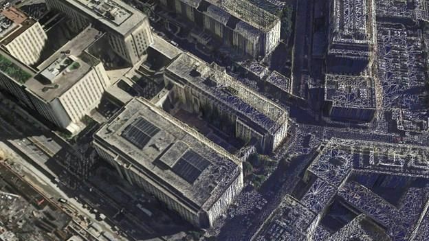
Once our dense point cloud has been generated, the next step is to create a continuous surface by connecting the points into triangles to reconstruct a surface. The software uses neighboring points to form a network of small, non-overlapping triangles that reveal the shape of the terrain, buildings and objects. This step transforms our set of points into a continuous 3D structure, making it easier to apply textures, analyse surfaces for visualisation and simulation.
To make the triangular mesh easier for the human eye to interpret, we overlay satellite imagery in a process known as texturing. Using known positions and angles from our previous alignment step, we project the satellite image onto the corresponding part of the mesh. Areas of the mesh covered by multiple images get blended to select the most accurate and least distorted pixels. Each triangle of the mesh now corresponds to a section of the 2D image, ensuring the texture “sticks” correctly. The result is a continuous texture map that wraps around the mesh.
Final steps and exporting
Once you have your textured mesh, it is up to you whether you wish to add further elements (electric poles, clouds, wildlife), with seasonal varieties or thematic layers (e.g. land use maps). Your 3D mesh forms your foundational framework upon which you can build geometry, textures, environmental effects, GIS data and interactively turn it into immersive 3D environments!
The textured mesh can easily be exported into as an OBJ, FBX, gITF or other 3D formats to make the model ready for GIS visualisation, simulation and more.
With the steps for creating 3D Mesh products described above, Airbus supports right from the beginning of the process by providing access to our high resolution Pléiades Neo satellite data. Thanks to Pléiades Neo’s 30cm resolution imagery you can create your own 3D products with unmatched quality and accuracy. Task one of our satellites to acquire your own multi-stereo imagery over your precise area of interest. We have facilitated the journey for our GIS experts who wish to compute their own 3D products by offering 3D-Ready Tasking, an option of our OneTasking service, to ensure you get the best images for your added-value product.
Did you find what you were looking for?
Speaking with the Airbus team is the best way to get started.