Home
Resources
Satellite Image Gallery
Various
Arizona, USA Satellite image f...
Sensor
Strat-ObserverResolution
-
Location
Arizona, United States of America
Copyright
OPAZ Images - © Airbus DS
Date
01 January, 2019
Image type
Optical
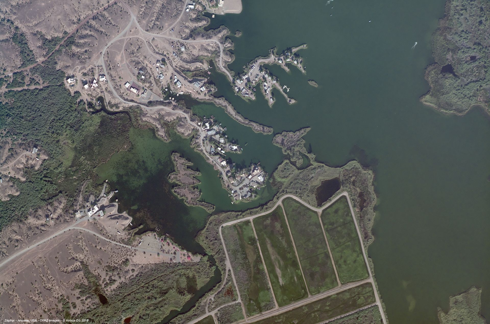
This image depicts a section of the state of Arizona, in the United States of America. Arizona is the sixth largest and the 14th most populated of the 50 American states. The image was taken on 01/01/2019 by the Zéphyr High Altitude Platform Station from Airbus.
The image shows a detailed stratospheric view of a mix of natural and man-made elements, including desert landscapes, agricultural fields, and infrastructure such as roads and buildings. A large lake is visible and takes up much of the right-hand side of the frame. The middle of the image is dominated by a small village situated on an outcrop. Buildings, vehicles, docks, and boats are visible when zoomed in.
The top left shows the last of the settlement buildings leading into a sandy desert area while the top right of the image shows green lake water leading into a densely vegetated area. Going from the bottom left to the bottom right shows a sparsely vegetated desert area leading to man-made fields and the lake taking up the bottom right corner. The overall image showcases the natural beauty and harshness of the Arizona desert environment and highlights the region's sparse population density.
The image was captured by the Airbus Zéphyr, a world-record-breaking High Altitude Platform Station (HAPS). Zéphyr is equipped with the Strat-Observer which is able to transmit very high-resolution images and live video from the stratosphere. The Strat-Observer equipment can cover 2500 km² per day at 18cm resolution. The camera footprint of the Strat-Observer is 1 km². However, the steerable nature of the high-resolution optical camera allows it to be directed to any area within a 40 x 30 km radius at any time.