

Airbus and European partners deliver a new high-resolution view of Europe with VHR2024
Airbus has reached a major milestone in European Earth Observation with VHR2024, an ambitious satellite imagery program delivering very high-resolution coverage of Europe. Developed under the European Union’s Copernicus programme and managed by the European Space Agency (ESA), the initiative delivers a continent‑wide, cloud‑free Very‑High‑Resolution (VHR) reference dataset across 39 European countries and territories.
VHR2024: a new high-resolution view of Europe from space
From monitoring forests and agricultural land to tracking urban development and environmental change, satellite imagery plays an essential role in understanding and protecting our planet. With VHR2024, Airbus and its partners have taken another step forward in making high-quality Earth Observation data available to European institutions and its users.
- 6 million km² of satellite imagery
- 39 European countries and territories
- 2-metre spatial resolution
Acquired between 2023 and 2025, the imagery underwent rigorous quality checks to meet the demanding requirements of the Copernicus programme. An important innovation is the development of a seamless Europe-wide satellite imagery mosaic. Airbus built this mosaic exclusively from imagery gathered during the VHR2024 campaign, stitching together thousands of satellite “tiles” into one continuous, cloud‑free image that will serve as a benchmark for downstream Copernicus services. The dataset will support sectors such as forestry, land‑use management, agriculture and environmental monitoring.
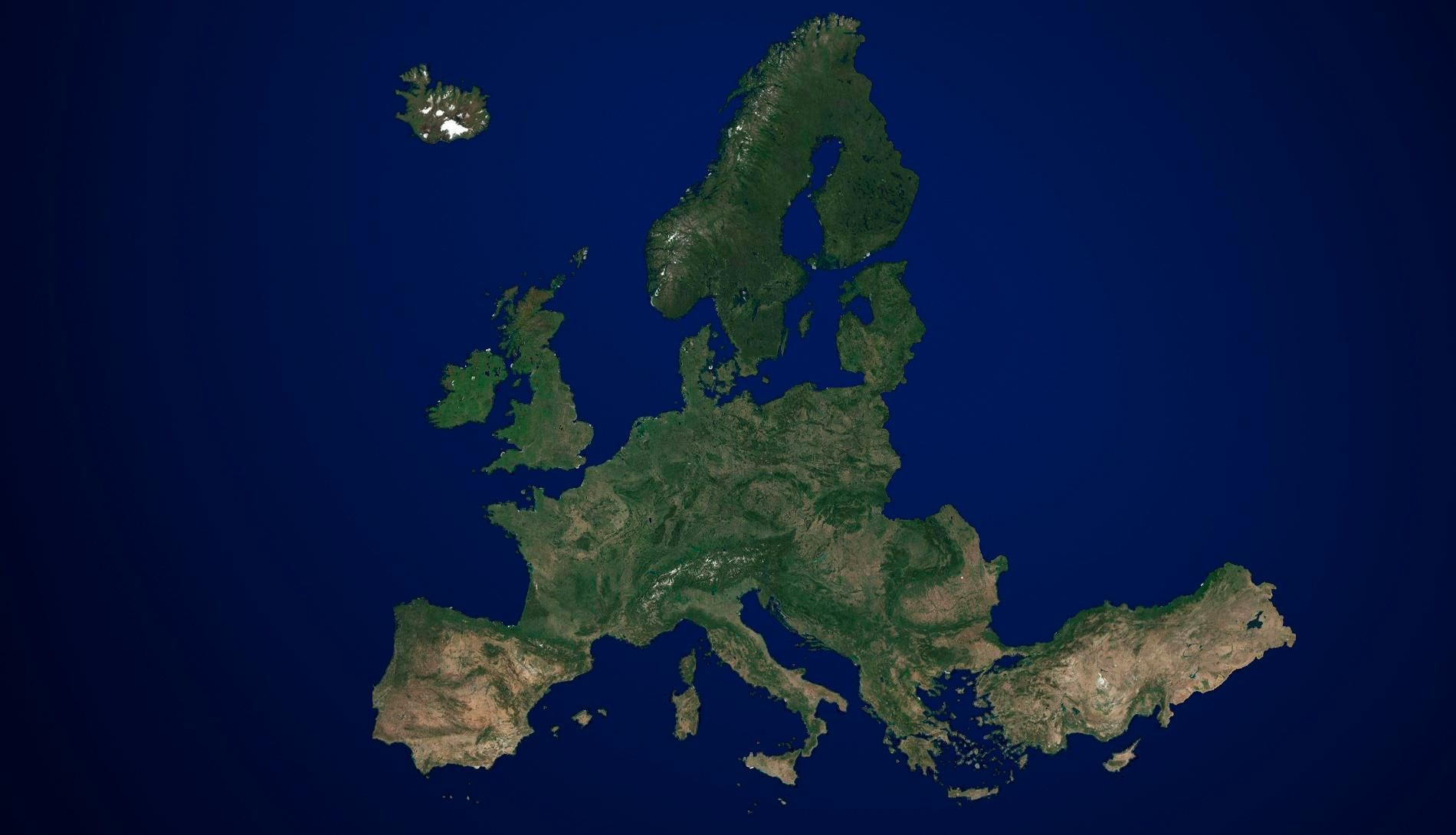
Airbus transforms VHR2024 satellite imagery into a harmonised, high-resolution mosaic of Europe
100% sourced from European satellite missions
VHR2024 was led by Airbus Defence and Space and combined imagery from four Airbus satellites - Pléiades Neo, Pléiades, SPOT‑6 and Vision‑1 - with data from GEOSAT‑2, provided by Portugal‑based GEOSAT. Data‑quality verification was carried out by Germany‑based GAF AG. All imagery was sourced exclusively from European Earth Observation satellites, underscoring the strength, maturity, and strategic autonomy of Europe’s EO ecosystem.
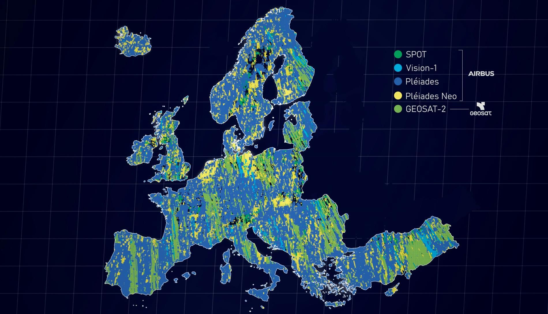
3 years of satellite acquisitions, combining multiple European sensors to deliver one comprehensive imagery coverage of Europe
Combining European expertise and space capabilities
Airbus acted as both prime contractor and satellite‑imagery provider for VHR2024, continuing a longstanding collaboration with European institutions to deliver trusted geospatial intelligence for public‑policy and operational decision‑making. This delivery reinforces Airbus’s commitment to Europe’s sovereign space capabilities and to providing reliable, high‑quality EO data for institutional users.
With VHR2024, Airbus has now contributed to all four Copernicus VHR programmes: VHR2015, VHR2018, VHR2021 and VHR2024. Across these campaigns, Airbus and its partners have continuously provided large‑scale, high‑accuracy satellite coverage that enables European institutions to monitor environmental change, support land‑management policies and strengthen climate‑resilience initiatives.
The VHR campaigns operate under the Copernicus Contributing Missions (CCM) framework, which supplies complementary satellite data to support Copernicus services and applications.

How to access the VHR2024 dataset
The VHR2024 dataset is now available to users through the Copernicus Data Space Ecosystem (CDSE) :
The VHR_IMAGE_2024: One cloud-free very high resolution optical coverage of EEA-39 (including islands and French DOMs) acquired within predefined windows corresponding to the vegetation season in 2023-2024-2025 (with an instrument GSD resolution of 2 meters).
The VHR_MOSAIC_2024 dataset is now available for download to authorised users through the Copernicus Data Space Ecosystem (CDSE).
Did you find what you were looking for?
Speaking with the Airbus team is the best way to get started.