

NASA: CSDA programme
The CSDA programme evaluates and procures data from commercial vendors that advance NASA’s Earth science research and applications activities. Data through the programme is available to NASA-funded researchers for scientific use. Airbus is committed to support NASA’s Earth Science mission through the programme.

HD15 imagery product Tasked over the Washington Monument in Washington D.C.
New product available: 15cm Imagery Product Tasking
This imagery product is derived from 30cm native Pléiades Neo data, designed to support high-precision geospatial analysis. It is now available for One Plan tasking, expanding access beyond archive-only HD15 data already provided under the Airbus CSDA contract.

0.5m DTM over Naples, Italy
New product available: 0.5 DTM - Elevation Models
The Pléiades Neo optical satellites can acquire imagery in stereo and tri-stereo modes to generate highly accurate elevation data for advanced 3D applications.
Elevation 0.5 is Airbus’ standard elevation product derived from Pléiades Neo stereo and tri-stereo imagery. Previously available as a Digital Surface Model (DSM) only, Elevation 0.5 has now been expanded to include Digital Terrain Model (DTM) outputs, as well as a combined Elevation 0.5 Bundle delivering both DSM and DTM in a single package.
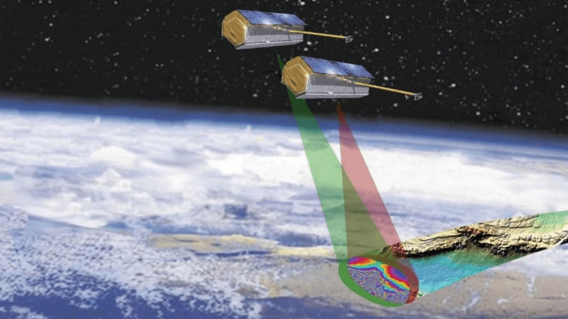
© Deutsches Zentrum fuer Luft- und Raumfahrt e. V. (DLR)
New product available: CoSSC (Co-registered Single Look Slant Range Complex)
Radar data from the TanDEM-X mission offers access to more than 1.4 million scenes collected globally since 2010. This unique archive supports 3D measurements, deformation monitoring, and change detection across a wide range of environments.

New product available: SRP (Space Reference Points)
Airbus Spatial Reference Points (SRPs), derived from SPOT6 and SPOT7 imagery, form a global Ground Control Point (GCP) reference layer for precise image registration.
Each SRP includes high-accuracy 3D measurements supported by SPOT image chips, enabling improved geolocation for optical imagery with lower native positional accuracy. With more than 70 million reference points, the SRP dataset provides robust global coverage (excluding Greenland and Antarctica) for applications requiring highly accurate ground control at regional to global scales.
New imagery collections to support NASA disasters Programme
Pleiades Neo (30 cm) data from Airbus Defence and Space is now available, offering ~3.5 m geolocation accuracy while supporting disaster research with very high-resolution imagery and flexible tasking options for new image collection.
This enables rapid damage assessment, detailed mapping of affected areas and improved situational awareness to guide emergency response and recovery efforts.

Enid, Oklahoma - Pléiades Neo 30 cm imagery
Our capacities
Additional options
INSAR and maritime data packages are available with the radar imagery products.
What Airbus data is not available through the CSDA programme?
Currently, Imagery Basemaps, SRPs and 3D Textured Models are not available through the programme. Contact us if you are interested in these options.
How to get started?
To learn more about the CSDA Programme, visit the NASA Earthdata CSDA website.
NASA CSDA Hosted Webinar. Learn more about Airbus data offerings through the CSDA programme.
1:12:30
Questions about Airbus data available through the programme?
Please complete this form to receive the full breakdown of available Airbus data.